
Sep 15, 2022
Image courtesy of iStock UCM Digital Health (UCM), a telehealth provider that offers a digital platform, a team of providers, and round-the-clock triage and treatment services, has announced a joint program with the Albany County Sheriff’s Office, in conjunction with...
Aug 30, 2022
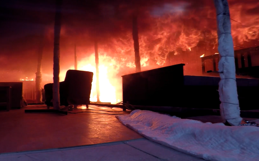
A view from NIST’s Burn Observation Bubble (BOB) of a burning structure during an experiment, one minute before flashover. / Credit: NIST By Catherine DorroughResearchers at the National Institute of Standards and Technology (NIST), the Hong Kong Polytechnic...

Aug 4, 2022
Geographic Information System mapping gives first responders a powerful suite of tools to organize search grids, track evidence in real time, and find citizens stranded in wilderness and urban environments. Learn how to effectively utilize this tech in the field, when...
Jul 22, 2022
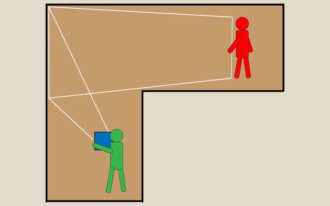
Even though the figure in red lies hidden, out of the direct line of sight of the figure in green, radiation naturally emitted by the concealed figure at submillimeter wavelengths betrays its presence. At these long wavelengths, many types of walls act as partial...
Jul 12, 2022
Onsite at GISAA’s recent search and rescue training exercise in Baileyton, AL. Courtesy of Keith Conville This spring, the GIS Association of Alabama held a two-day search and rescue training event that brought together several organizations and individuals from...

Jul 11, 2022
Aerial image of the Kirkland, Washington waterfront at Lake Washington. Credit: iStockphoto By Catherine DorroughWashington state’s King County Fire Chiefs Association and Medic One Foundation recently announced the county-wide launch of PulsePoint, a mobile app that...
Page 4 of 6« First«...23456»
Recent Comments